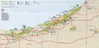
I'm originally from the Calumet Region, which stretches along the shoreline of Lake Michigan from the southside of Chicago to Michigan City, Indiana. The region has the greatest concentration of natural diversity in the United States, and some of the worst pollution. It has produced great economic wealth, but also suffers a high level of poverty. These contradictions can help to be reconciled with the right kind of communication resources. The Field Museum in Chicago helped to coordinate an innovative, participatory research program that combined the efforts of community residents, academics, and GIS and visual ethnography to create a social asset map of the region.
No comments:
Post a Comment